The County-Is-One-Story Mistake
County character is richer than its best-known landmark. Learn to describe a county through distinct places, connections and built heritage without flattening its variety.
A visitor steps off the train, sees the old market hall above the rooftops and asks what the county is like. The answer comes easily: market towns, perhaps, or stone buildings and rolling fields. Yet the station lies near one edge, the hall belongs to one town, and the road beyond it soon enters a district with a different building tradition. County character cannot be read from a single landmark. The county-is-one-story mistake begins when a memorable place is asked to stand for all the others.
This is not an argument against landmarks. A castle, bridge, mill or civic square may give a county a strong public image and help people find their bearings. The problem is treating that image as a complete portrait. A more careful account keeps the landmark in view while asking what it represents, what it leaves out and how it connects to neighbouring places.
The landmark’s reach
Built heritage is especially persuasive because it is visible and specific. A medieval parish church, a row of workers’ cottages or a grand railway station can make a place seem legible at once. Its materials and layout invite a story: local stone, a former trade, a growing town. But the story usually belongs first to that building and its setting. Extending it across a whole county takes further evidence.
Consider what lies around the landmark. Is it in a county town, a port, an upland village or a suburb on a boundary? Did the building serve people from nearby settlements, or mainly those who lived within walking distance? A courthouse may speak to the county’s administrative life, while a canal warehouse points towards a route linking several towns. Neither says the same thing about every district.
There is also a difference between what survives and what was once common. A prominent building may have escaped demolition because it was unusually durable, useful or admired. Its survival makes it visible, not necessarily typical. A modest timber-framed house, a line of terraced streets or a cluster of farm buildings may tell a broader story, even if none has become the county’s familiar image.
Begin by naming a landmark precisely: what it is, where it stands and what it can reasonably illustrate.
Several local characters
A county is an administrative area, but its lived character often changes across its extent. Differences may follow geology, routes, settlement patterns, industries or the presence of a large town. Some are gradual; others are sharp. A river valley may bring settlements together along a corridor, while a ridge makes neighbouring places feel oriented towards separate markets. County identity gathers these local identities without erasing them.
The built environment gives useful clues. Compare the materials used in houses and boundary walls, the position of churches and greens, or the way a high street meets an older road. In one district, stone farmsteads may sit among dry-stone walls; elsewhere, brick terraces may follow a railway or former industrial route. These contrasts do not need to be forced into a single origin story. They are part of the county’s character precisely because they differ.
Variation does not mean every parish needs equal space in an account. That would make a description unwieldy and obscure the larger pattern. Instead, distinguish between a recurring feature, a concentrated local tradition and a notable exception. A building style found across several market towns may be a regional pattern; a striking manor house may be important without representing the surrounding villages.
Use a small set of contrasting places to show how the county changes, rather than asking one place to carry the whole explanation.
A fuller county portrait
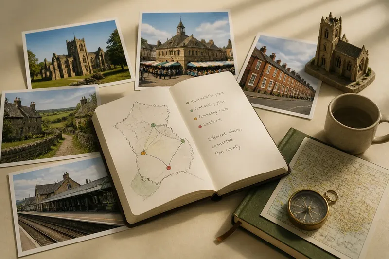
A useful county description can be built from four kinds of evidence. They are not a rigid formula, but a way to keep observation and interpretation in balance:
- A representative place: a settlement or landscape that helps explain a recurring feature, such as a chain of market towns or villages clustered around a common.
- A contrasting place: a district that complicates the first impression, perhaps a coastal settlement in a county often described through its inland farmland.
- A connecting route: a river, road, railway or historic track that shows how places exchanged people, goods or services.
- A landmark: a building or site that carries public recognition, described for what it reveals and for the limits of that evidence.
Imagine a writer describing a county through its stone abbey alone. The starting point is the abbey and the village around it; the writer then checks nearby market towns, a newer settlement beside a railway and a lowland district with brick buildings. By noting the abbey’s role in one local landscape, then tracing the routes and contrasts elsewhere, the writer can retain its importance without presenting it as the county’s universal type.
Maps can help choose those places. A county map shows the overall shape and the location of settlements; a historic map may reveal former routes, boundaries or lost industry. The map is a prompt for questions, not a substitute for local detail. A line that looks like a natural division may have been crossed daily, while two places close together may have looked towards different centres.
Keep the description anchored to places a reader can locate, and make clear when an observation applies only to one district.
Questions about county character?
Can one landmark represent a county?
It can represent an important strand of county identity, especially if people widely recognise it or it reflects a significant local role. It cannot, by itself, establish that every district shares the same history, architecture or landscape.
How many places should a portrait include?
There is no fixed number: include enough places to show the pattern and at least one meaningful contrast. Choose them for what they reveal, not simply because they are famous or easy to name.
What if one town dominates the county’s image?
Explain why that town has become prominent, then identify the places and routes beyond it that give the county a wider shape. The town’s influence can be real without making the rest of the county an afterthought.
How can a writer avoid flattening local differences?
Use precise geographical language, distinguishing a town, district, valley or coast from the county as a whole. Qualify broad claims with the places that support them, and mention a counterexample where it changes the picture.
Words that keep scale
Small choices of wording can turn a fair observation into an overstatement. “The county is built of local stone” sounds comprehensive; “stone is prominent in the upland villages” identifies both the material and its setting. “Its towns grew around the market” may imply one shared history, while “several market towns still shape local routes” allows for other patterns.
Distinguish between an established feature and an impression. “The church tower dominates the village skyline” describes something a reader can check. “The county is defined by its churches” makes a broader claim that needs evidence across different districts. Words such as “often”, “in parts of” and “around” are not evasions when they express the actual reach of an observation.
It also helps to separate recognition from representativeness. A castle may be the image most associated with a county; a scattered group of ordinary buildings may better show how people lived in a particular area. Both matter, but they answer different questions. One describes public memory; the other describes a local pattern of settlement and construction.
Before making a county-wide claim, ask whether the sentence would still hold in a different district.
Identity through connection
Variety is not a collection of unrelated fragments. Roads, rivers, railways, markets and administrative centres have connected places, sometimes strongly and sometimes unevenly. Built heritage can show those relationships: a bridge links settlements across a river; a station redirects journeys towards a larger town; a row of inns marks an old route. Such features help explain how local differences sit within a shared county geography.
Connections can also explain why a landmark matters beyond its immediate setting. A county hall may draw visitors from across the area, while a mill may have depended on a river system serving several settlements. Describe the relationship rather than assuming it. Ask who used the place, which routes reached it and whether the connection still shapes movement or identity.
The county-is-one-story mistake is not solved by replacing a famous landmark with a longer list of attractions. It is solved by showing scale: what belongs to one place, what recurs across several, and what ties different places together. A county portrait becomes more convincing when its differences are visible and its connections are named.
When describing county character, let a landmark open the account, not close it. Pair its local story with a contrasting district and a route between places; that is often enough to give the reader a more truthful sense of the whole.